Pictures Of You From Space (With Bonus Quiz!)
Pictures Of You From Space (With Bonus Quiz!)

Do you ever wonder how many pictures there are with you in the background? Like, the ones taken at crowded bars during other people’s birthdays; or when you stroll through someone else’s shot at a tourist attraction; or when you get good seats at a game? You’re probably in the background of thousands upon thousands of photographs — and you’re probably making a stupid face in every single one of them. On top of this, your picture also is being taken daily in ways you may not be aware of: from 400 miles above, by the satellites used to observe the earth. Lucky for your face, you’re too small to appear, given the resolution capabilities. But you’re still being ‘remotely sensed,’ your house a blip that appears as part of the imagery, in the same way you’re a part of someone else’s photo album.
‘Remote sensing’ is a fancy term for looking at something without actually being near it. Or, as I called my college class on the subject, “looking at stuff from space.” The term encompasses lots of technologies — RADAR, LiDAR, aerial photography, etc. — but today we’re talking about satellites, specifically, imagery and observation satellites. Then let’s see how good you are at recognizing things from space.

This is a first photograph of Earth taken by a satellite. It was captured by Explorer 6 on August 14, 1959. That white smeary thing is an image of Pacific clouds, taken at an angle while the satellite passed over Mexico. As a total coincidence, August 14 1959 is Magic Johnson’s birthday. Can you imagine if he had been in Space Jam? I would have had a connection to make here. Oh, well. (This is just one of the many great missed coincidences in 1959. On the same day the Buffalo Bills were established — Oct. 28 — Lycra was introduced to the world. What if the Bills were a swim team?! The mind reels.)
The space race kept imagery technology advancing at an impressive clip. By 1972, the same year the famous Blue Marble photograph was taken by astronauts aboard Apollo 17, NASA was launching the Earth Resources Technology Satellite, later known as the first of the Landsat birds.* There are hundreds of satellites up there, taking images as they pass overhead. India has a team of satellites, Argentina, even Sweden has one.
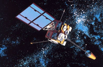
Some of them, like GOES-8 here, make me want to play air guitar.
Others, like Sweden’s Munin, look like a model of my dad’s office building.

The Landsat program (first run by NASA but transitioned to NOAA control during the Carter administration) has launched six successful satellites into orbit (and one failure into the ocean). The team of satellites have captured millions of images of the earth over nearly 40 years of service, providing a constantly growing, publicly accessible library of the changes taking place across the surface of the planet; it’s an invaluable resource for everything from urban planning to forest monitoring. The two Landsats currently functioning, 5 and 7, have fallen on hard times. Landsat 5 is in a 90-day break imposed this November after a critical component was found to be heavily degraded. But don’t feel too bad for ol’ fivey; it was launched in 1984 and was predicted to last three years. Landsat 5 has functioned for 24 years beyond expectations. Landsat 7, launched in 1999, suffered a failure four years later of the Scan Line Corrector, a component that kept images taken parallel to each other. Though 5 and 7 may sound a little bruised, help is on the way: Landsat 8, the Landsat Data Continuity Mission, is scheduled for a launch in early 2013.
These Landsats, like most imagery satellites, follow a polar orbital path — they circle the earth from pole to pole and back up again, crossing the equator at a different location on each pass — as demonstrated in this animation. The Landsats have a revisit time — that is, the time it takes to cover every image-able surface — of 16 days, but newer satellites have a revisit time as short as two days.
As I said, the Landsats aren’t the only satellites up there. In addition to God knows how many military satellites (have you ever looked at a launch schedule? Stuff is being tossed into space all the time), there are a pair private-sector companies, Digital Globe and GeoEye, operating earth observation satellites. These companies provide extremely high-resolution imagery to many companies, including Google. Next time you’re on Google Earth or Maps, check the credit bar. Most often you’ll see one (or both!) of those names credited at the bottom. In fact, GeoEye’s 2008 launch of GeoEye-1 even carried the Google logo on the side of the rocket, leading many people (who neglected to read whatever text was near photos of the thing) to believe that Google itself was launching a satellite.
Meanwhile, satellites in a geosynchronous orbit, mostly weather satellites, hover above the same place on the planet, following the earth’s rotation. The United States’ GOES (Geostationary Operational Environmental Satellite) and the EU’s Meteosat are both such networks. Among many other uses, the National Hurricane Center uses GOES imagery to track storms during hurricane season. Many of those satellites are not active at the moment, but some birds are designated to update every 30 minutes. You can check them out here. There was actually some big news on the GOES front these past weeks as GOES-11 (the eleventh GOES launched), having faithfully imaged the Pacific as GOES-West since 2000, was decommissioned (see its last photo here, under a truly apocalyptic headline). A decomissioned satellite, by the way, will probably not crash down to earth ROSAT-style. Most are just sent outward in what’s called ‘a graveyard orbit,’ there to float with other decommissioned satellites, assorted debris and space junk.
Now a quiz! Can you name what you’re seeing in these nine images? Answers follow below.
1.

2.

3.

4.
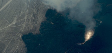
5.
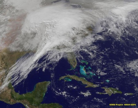
6.
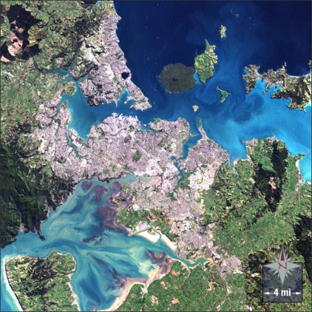
7.
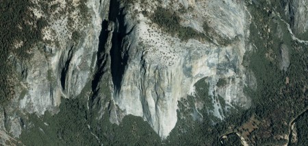
8.
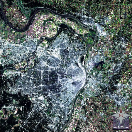
9.
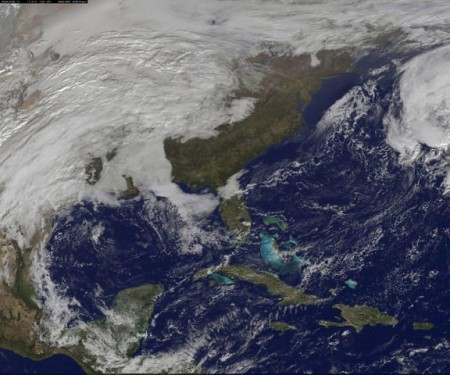
Answers:
1. Baghdad (satellite image by Landsat)
2. Obama inauguration (satellite image by GeoEye)
3. Hurricane Irene (satellite image by GOES )
4. Eyjafjallajokull Volcano (satellite image by GeoEye )
5. Feb. 1, 2011 East Coast Blizzard (satellite image by GOES )
6. Auckland (satellite image by Landsat)
7. El Capitan (satellite image by GeoEye )
8. St. Louis (satellite image by Landsat)
9. This morning’s view (satellite image by GOES)
* Technical jargon!
Victoria Johnson is a cartographer and this is her Tumblr.
Other images: Explorer VI satellite courtesy of NASA, via Wikipedia; GeoEye launch photo courtesy of GeoEye; GOES-1 graphic courtesy of NOAA Photo Library, via Wikipedia; Munin satellite picture courtesy of its website.
